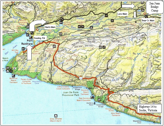
 Southwest Vancouver Island, British Columbia. Click on the map for a larger version.
Get out your road maps! About 20 km west of Victoria, find Highway 14 (Sooke Road/West Coast Road) starting in Langford and Colwood. Take Highway 14 west through Sooke and Jordan River to Port Renfrew (about 110 km – 70 miles.) In Port Renfrew, opposite the tourism information building, look for the sharp downhill right turn on Deering Road. The sign points to Lake Cowichan. Take Deering Road across the long narrow bridge across the estuary. Stay on Deering Road past the Pacheedaht Campground. After 3 kilometers, reach a T intersection. Turn right on Harris Creek Main (paved) – signs point to Fairy Lake, Lizard Lake, Mesachie, Lake Cowichan. Stay on Harris Creek for another 13 km. Watch for Wild Earth sign and turn right on Lens Main (graded dirt road.) Stay on Lens Main for 2.5 km to the Triangle (a three-way intersection). Turn right onto Bear Creek Main (graded dirt) and go another 2 km. Just past the bridge over the San Juan River on the left hand side is the San Juan Bridge campsite, home of the world's largest Sitka Spruce. Park on Bear Creek Main using the turnaround just past the campsite on the right, and walk in.
